Coastal cliff · over 4 km · up to 20 m high
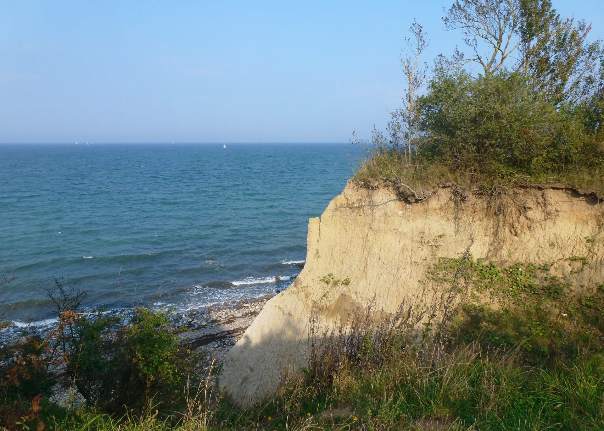
Brodten cliff
North of Travemünde the coast breaks off: the Brodten cliff is a coastal cliff over four kilometres long, up to 20 metres high, between Travemünde and Niendorf. Along the top a walking and cycling path follows the edge, below lies the beach – and the whole coast retreats a little year by year. A trip for hikers, bird lovers and anyone who wants to see the Baltic from above.
The cliff in numbers
- > 4 km Length of the cliff
- up to 20 m Height above the beach
- 50–100 cm Retreat per year
- ≈ 2,600 Sand-martin nest tubes
The shore walk
The path runs along the top edge between Travemünde and Niendorf/Ostsee – a good four kilometres with a wide view over Lübeck Bay. You can start in Travemünde (at the northern end of the Kurstrand) and walk to Niendorf or vice versa; the bus is handy for the way back. Below by the water a beach section runs along, but it is not continuously passable at high water and after landslides – the top is safer and offers more to see.
A coast that moves
The cliff is a living coast: wind, waves and rain erode it by an average of 50 to 100 centimetres per year. Between 1810 and 1900 the coast lost around 100 metres. This natural dynamic cannot be permanently stopped – the break-off edges are real, so both above and below: keep your distance from the edge and take barriers seriously. It is exactly this erosion that keeps exposing glacial boulders and fossils on the beach.
Sand martins and bird protection
One of Europe’s largest sand-martin colonies breeds in the open cliff faces – around 2,600 nest tubes in the sand. The cliff is designated a European bird protection area. From the paths the activity can be watched well without disturbing the breeding walls – please stay on the paths.
Best light
The cliff lies on the western edge of Lübeck Bay and faces east over the open water – in the morning the sun stands over the sea and bathes the walls in warm light. When exactly the sun rises and sets today and where to stand best is shown by the sun module on the home page.
Frequently asked questions about the Brodten cliff
How long is the Brodten cliff?
The coastal cliff is over four kilometres long and up to 20 metres high. It runs between Lübeck-Travemünde and Niendorf/Ostsee along Lübeck Bay.
Can you hike along the Brodten cliff?
Yes. Along the top a walking and cycling path runs the good four kilometres between Travemünde and Niendorf, with a wide view over the Baltic. The bus is handy for the way back.
How strong is the coastal erosion at the cliff?
On average the coast retreats by about 50 to 100 centimetres per year; between 1810 and 1900 it was around 100 metres. The natural erosion cannot be permanently stopped – keep your distance from the break-off edge.
What animals live at the Brodten cliff?
One of Europe’s largest sand-martin colonies breeds in the cliff walls, with around 2,600 nest tubes. The cliff is a European bird protection area.
How do I get from Travemünde to the cliff?
From the northern end of the Kurstrand the path leads straight to the cliff; on foot or by bike you are there in a few minutes. Hikers walk the route as far as Niendorf.